![](/images/other/stat-length.png)
![Tocht Te voet Rychnov u Jablonce nad Nisou - NS manželů Scheybalových 1. část - Photo](https://media.geolcdn.com/t/1900/400/20c24816-e22e-43ee-bd40-11c6a6522ec7.jpeg&format=pjpeg&maxdim=2)
NS manželů Scheybalových 1. část
SityTrail - itinéraires balisés pédestres
Tous les sentiers balisés d’Europe GUIDE+
![Lengte](/images/other/stat-length.png)
Lengte
6,8 km
![Max. hoogte](https://static1.geolcdn.com/siteimages/upload/files/1508320355ic_sort_altitude_max_24dp.png)
Max. hoogte
659 m
![Positief hoogteverschil](https://static1.geolcdn.com/siteimages/upload/files/1508320355ic_sort_den_pos_24dp.png)
Positief hoogteverschil
150 m
![Km-Effort](/images/other/stat-length.png)
Km-Effort
9 km
![Min. hoogte](https://static1.geolcdn.com/siteimages/upload/files/1508320355ic_sort_altitude_min_24dp.png)
Min. hoogte
462 m
![Negatief hoogteverschil](https://static1.geolcdn.com/siteimages/upload/files/1508320355ic_sort_den_neg_24dp.png)
Negatief hoogteverschil
218 m
![Boucle](https://static1.geolcdn.com/siteimages/upload/files/16400158638029165_repeat_loop_refresh_sync_direction_icon.png)
Boucle
Neen
Markering
Datum van aanmaak :
2025-02-07 12:21:37.972
Laatste wijziging :
2025-02-07 12:21:37.972
![Te voet](https://static1.geolcdn.com/sitytour/trail-icons/100.png)
2h02
Moeilijkheid : Gemakkelijk
![Scan deze QR-code om de tocht te openen in de SityTrail-applicatie](https://capi.geolives.com/qq0zvz2zws4bq2lad0pu/sitytour/trails/4345559/qr.png?size=200)
Gratisgps-wandelapplicatie
Over ons
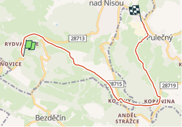
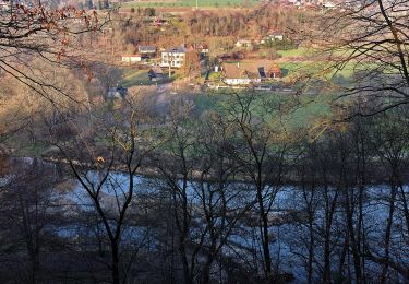
Tocht Te voet van 6,8 km beschikbaar op Noordoost, Liberecký kraj, Rychnov u Jablonce nad Nisou. Deze tocht wordt voorgesteld door SityTrail - itinéraires balisés pédestres.
Beschrijving
Tocht aangemaakt door cz:KČT.
Plaatsbepaling
Land:
Czech Republic
Regio :
Noordoost
Departement/Provincie :
Liberecký kraj
Gemeente :
Rychnov u Jablonce nad Nisou
Locatie:
Unknown
Vertrek:(Dec)
Vertrek:(UTM)
508600 ; 5613269 (33U) N.
Opmerkingen
Wandeltochten in de omgeving
![Tocht Te voet Frýdštejn - NS manželů Scheybalových 2. část - Photo](https://media.geolcdn.com/t/375/260/045c8d07-5395-40bc-80ac-bd7470fe0be2.jpeg&format=jpg&maxdim=2)
![Te voet Te voet](https://static1.geolcdn.com/sitytour/trail-icons/100.png)
NS manželů Scheybalových 2. část
Te voet
Gemakkelijk
Frýdštejn,
Noordoost,
Liberecký kraj,
Czech Republic
![](/images/other/stat-length.png)
8,6 km | 10,5 km-effort
2h 23min
![](https://static1.geolcdn.com/siteimages/upload/files/16400158638029165_repeat_loop_refresh_sync_direction_icon.png)
Neen
![Tocht Te voet Rychnov u Jablonce nad Nisou - [Ž] Rychnov u Jablonce n. N. - Dobrá Voda - Photo](https://media.geolcdn.com/t/375/260/6d19918f-d3e9-4534-a7af-5e0a5166a0c2.jpeg&format=jpg&maxdim=2)
![Te voet Te voet](https://static1.geolcdn.com/sitytour/trail-icons/100.png)
[Ž] Rychnov u Jablonce n. N. - Dobrá Voda
Te voet
Gemakkelijk
Rychnov u Jablonce nad Nisou,
Noordoost,
Liberecký kraj,
Czech Republic
![](/images/other/stat-length.png)
3,2 km | 5,2 km-effort
1h 11min
![](https://static1.geolcdn.com/siteimages/upload/files/16400158638029165_repeat_loop_refresh_sync_direction_icon.png)
Neen
![Tocht Te voet Dlouhý Most - [Z] Rašovské sedlo;Kohoutivice - Photo](https://media.geolcdn.com/t/375/260/7ed4b2bc-fca7-447f-aff9-a1e465f66f36.jpeg&format=jpg&maxdim=2)
![Te voet Te voet](https://static1.geolcdn.com/sitytour/trail-icons/100.png)
[Z] Rašovské sedlo;Kohoutivice
Te voet
Gemakkelijk
Dlouhý Most,
Noordoost,
Liberecký kraj,
Czech Republic
![](/images/other/stat-length.png)
5,8 km | 7,1 km-effort
1h 37min
![](https://static1.geolcdn.com/siteimages/upload/files/16400158638029165_repeat_loop_refresh_sync_direction_icon.png)
Neen
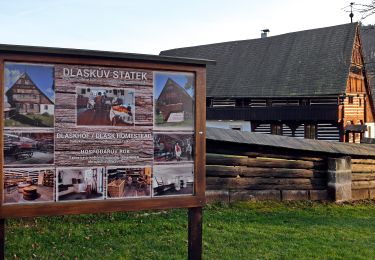
![Tocht Te voet Hodkovice nad Mohelkou - [Ž] Hodkovice nad Mohelkou - Vrchovina - Photo](https://media.geolcdn.com/t/375/260/c8a4d6e6-c436-4c58-854e-1aa3f07f7648.jpeg&format=jpg&maxdim=2)
![Te voet Te voet](https://static1.geolcdn.com/sitytour/trail-icons/100.png)
[Ž] Hodkovice nad Mohelkou - Vrchovina
Te voet
Gemakkelijk
Hodkovice nad Mohelkou,
Noordoost,
Liberecký kraj,
Czech Republic
![](/images/other/stat-length.png)
3,3 km | 4,4 km-effort
1h 0min
![](https://static1.geolcdn.com/siteimages/upload/files/16400158638029165_repeat_loop_refresh_sync_direction_icon.png)
Neen
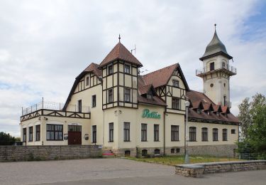
![Tocht Te voet Liberec - [Ž] Nad Kunraticemi - Milíře - Photo](https://media.geolcdn.com/t/375/260/249d98fd-78e3-4280-be9f-ce1815c11ae6.jpeg&format=jpg&maxdim=2)
![Te voet Te voet](https://static1.geolcdn.com/sitytour/trail-icons/100.png)
[Ž] Nad Kunraticemi - Milíře
Te voet
Gemakkelijk
Liberec,
Noordoost,
Liberecký kraj,
Czech Republic
![](/images/other/stat-length.png)
5,7 km | 7,8 km-effort
1h 46min
![](https://static1.geolcdn.com/siteimages/upload/files/16400158638029165_repeat_loop_refresh_sync_direction_icon.png)
Neen
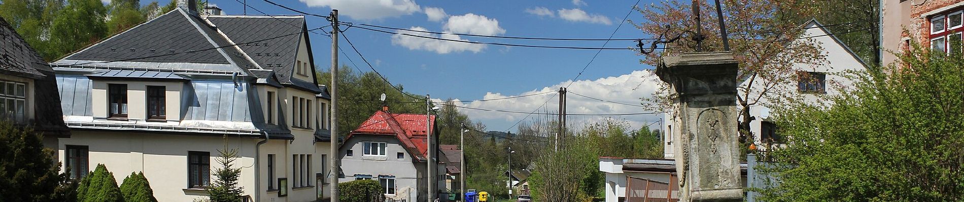
![Tocht Te voet Pulečný - [Z] Jablonec n. N. - Pulečný - Photo](https://media.geolcdn.com/t/375/260/b17bcafe-ad71-4f5a-9387-b5078f702632.jpeg&format=jpg&maxdim=2)
![Te voet Te voet](https://static1.geolcdn.com/sitytour/trail-icons/100.png)
[Z] Jablonec n. N. - Pulečný
Te voet
Gemakkelijk
Pulečný,
Noordoost,
Liberecký kraj,
Czech Republic
![](/images/other/stat-length.png)
12,1 km | 18,5 km-effort
4h 12min
![](https://static1.geolcdn.com/siteimages/upload/files/16400158638029165_repeat_loop_refresh_sync_direction_icon.png)
Neen
![Tocht Te voet Jenišovice - Naučná stezka Josefa Pekaře - Photo](https://media.geolcdn.com/t/375/260/045c8d07-5395-40bc-80ac-bd7470fe0be2.jpeg&format=jpg&maxdim=2)
![Te voet Te voet](https://static1.geolcdn.com/sitytour/trail-icons/100.png)
Naučná stezka Josefa Pekaře
Te voet
Gemakkelijk
Jenišovice,
Noordoost,
Liberecký kraj,
Czech Republic
![](/images/other/stat-length.png)
4,2 km | 5 km-effort
1h 8min
![](https://static1.geolcdn.com/siteimages/upload/files/16400158638029165_repeat_loop_refresh_sync_direction_icon.png)
Neen
![Tocht Te voet Jablonec nad Nisou - Vnitřní turistický okruh Jablonec nad Nisou - Photo](https://media.geolcdn.com/t/375/260/70b64b81-27fc-4d5f-bbe4-ec23ddcc81ec.jpeg&format=jpg&maxdim=2)
![Te voet Te voet](https://static1.geolcdn.com/sitytour/trail-icons/100.png)
Vnitřní turistický okruh Jablonec nad Nisou
Te voet
Gemakkelijk
Jablonec nad Nisou,
Noordoost,
Liberecký kraj,
Czech Republic
![](/images/other/stat-length.png)
6,5 km | 9 km-effort
2h 2min
![](https://static1.geolcdn.com/siteimages/upload/files/16400158638029165_repeat_loop_refresh_sync_direction_icon.png)
Ja
![Tocht Te voet Malá Skála - NS Průlom Jizery - Photo](https://media.geolcdn.com/t/375/260/3196a217-b809-4ccb-b1be-668c637f7d9b.jpeg&format=jpg&maxdim=2)
![Te voet Te voet](https://static1.geolcdn.com/sitytour/trail-icons/100.png)
NS Průlom Jizery
Te voet
Gemakkelijk
Malá Skála,
Noordoost,
Liberecký kraj,
Czech Republic
![](/images/other/stat-length.png)
7,2 km | 8,1 km-effort
1h 49min
![](https://static1.geolcdn.com/siteimages/upload/files/16400158638029165_repeat_loop_refresh_sync_direction_icon.png)
Neen